Charting the Natural Beauty: An Adventure Through Mount Ainos, Kefalonia, via Web GIS
Introduction:
Tucked away on the captivating island of Kefalonia, Mount Ainos rises as a testament to the unspoiled wonders of nature. This mountain isn’t just a geographical feature; it’s a living embodiment of Greece’s natural magnificence. In our quest to explore, understand, and protect the remarkable biodiversity of this unique locale, we’ve partnered with the Kefalonia National Park Management Unit to create a specialized web GIS application.
Discovering the Enigmatic Mount Ainos:
Our partnership with the Kefalonia National Park Management Unit has resulted in the development of an intuitive and user-friendly web GIS application. This tool has been thoughtfully designed to provide adventurers, researchers, and nature enthusiasts with an immersive journey into the heart of Mount Ainos.
Notable Features of the Web GIS:
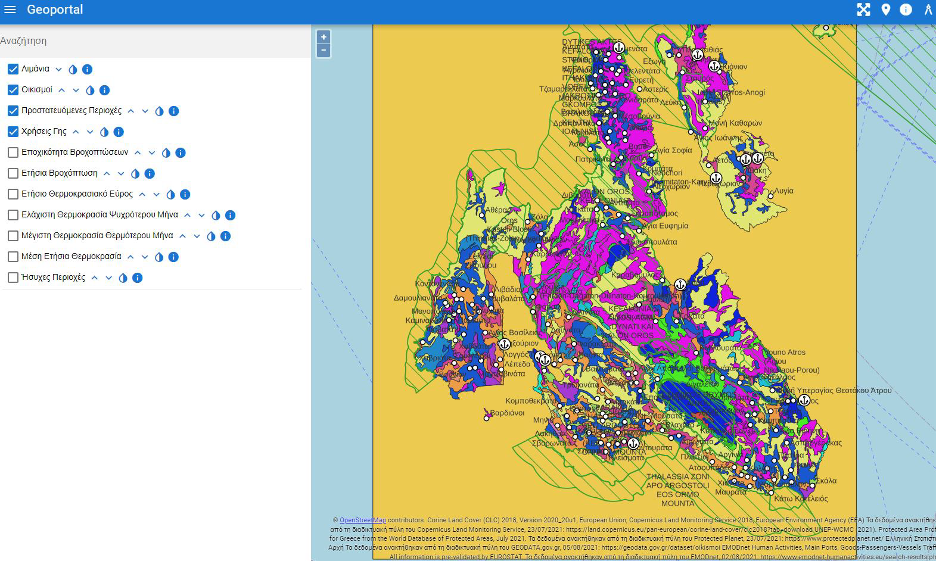
1. Geospatial Data Management: Through the use of open-source GIS technology, we’ve skillfully managed an extensive collection of geospatial data associated with Mount Ainos. This ensures a precise representation of the mountain’s unique ecosystems, geology, and topography.
2. Tailored Application: Our web GIS application is meticulously crafted to meet the specific needs of the Kefalonia National Park. It’s an intuitive, user-friendly companion accessible across various devices, ensuring it’s an ideal tool for park visitors.
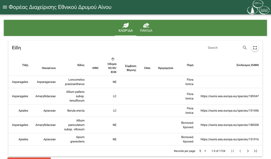
3. Biodiversity Database: At the heart of our web GIS is a comprehensive database, a treasure chest of information about the fauna and flora thriving on Mount Ainos. Users can delve into this rich repository to gain insights into the diverse array of life that graces the region.
4. Climate Insights: Climate is a key influencer in shaping the ecosystems on Mount Ainos. Our application offers users real-time and historical climate data, granting a deeper understanding of the mountain’s ever-changing weather patterns and their impact on biodiversity.
Embarking on a Journey Through Mount Ainos:
- Species Exploration: With just a few clicks, users can embark on a virtual voyage to uncover the remarkable diversity of species that make Mount Ainos their home. From rare bird species to unique plant varieties, our web GIS reveals the mountain’s rich biological tapestry.
- Educational Resources: Whether you’re a student, a researcher, or simply curious, the application offers a treasury of educational materials. Learn about the incredible adaptations of species that call the mountain home, the cultural significance of the area, and the ongoing conservation efforts.
- Planning and Navigation: Park visitors can rely on the web GIS for trip planning, checking trail conditions, and ensuring they respect the park’s ecological boundaries. Staying on marked paths guarantees a fulfilling experience.
Preserving and Sharing the Enchantment of Mount Ainos:
Our web GIS application is not merely a tool for exploration; it’s a commitment to the preservation of Mount Ainos and the biodiversity it houses. By sharing knowledge and fostering a deep appreciation for this natural treasure, we aspire to inspire a community of responsible caretakers, dedicated to safeguarding Mount Ainos for generations to come.
Conclusion:
Mount Ainos is a realm of unparalleled natural beauty and ecological importance, and our specialized web GIS application is your gateway to its concealed treasures. We invite you to embark on an exploration, discover, and learn about the biodiversity of this remarkable mountain, all while contributing to its ongoing conservation. Visit our web GIS, set out on your digital journey, and let the magic of Mount Ainos captivate your heart and imagination.

Leave a Reply